Mousam Way Land Trust
"Preserving special places for plants wildlife and the enjoyment of present and future generations"
Category: Property Listings
-
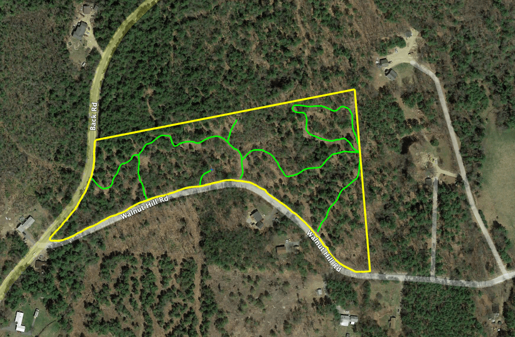
Morrow Environmental Reserve
Our only lot in Shapleigh, this 12,62 acre forested property is located at the northeast corner of the intersection of Back and Walnut Hill Roads. The back boundaries are marked by intermittent stonewalls. There are three entries along Walnut Hill Road, with off-road parking at the upper access. The latest 2011 timber harvest along with…
-

Lower Mousam Wetland Easement
In December of 2020, the City of Sanford connected a 390 acre solar project to the grid. This 50 MegaWatt system offsets an estimated ½ million tons of carbon dioxide emissions per year, was the largest solar project in Maine, and the largest solar project at an airport in the world. To satisfy the negatively…
-
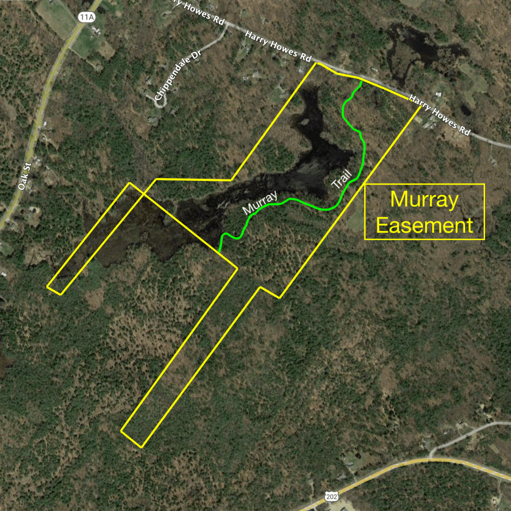
Murray Easement
In December of 2020, the City of Sanford connected a 390 acre solar project to the grid. This 50 MegaWatt system offsets an estimated ½ million tons of carbon dioxide emissions per year, was the largest solar project in Maine, and the largest solar project at an airport in the world. To satisfy the negatively…
-
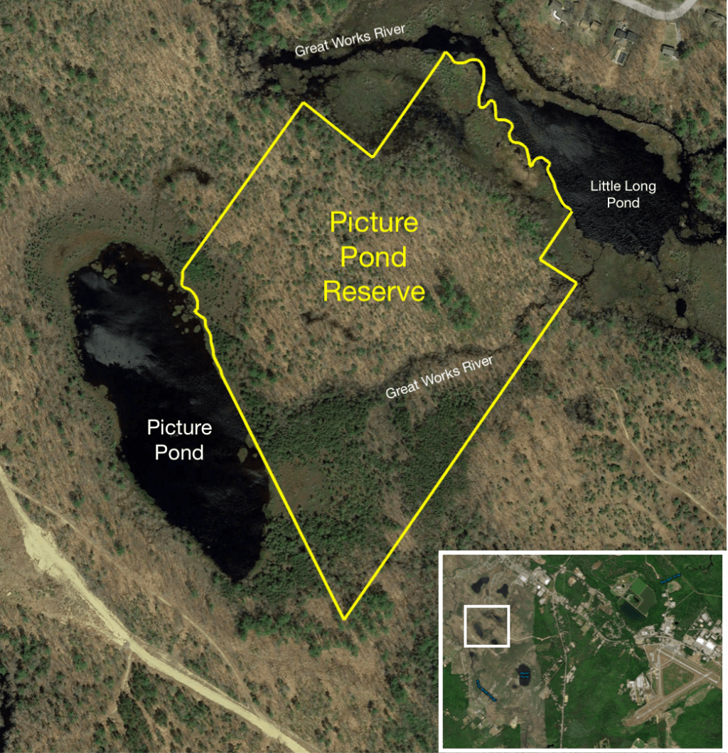
Picture Pond Reserve
Edwin Emery, in his book The History of Sanford, Maine, 1661-1900, describes how Picture Pond got its name: “The name of Picture Pond came from the “Picture Tree” standing on its shore, which received its name from the following circumstance: About 1754, ” a daughter of Peter Morrell, a Quaker, on the northeast side of…
-
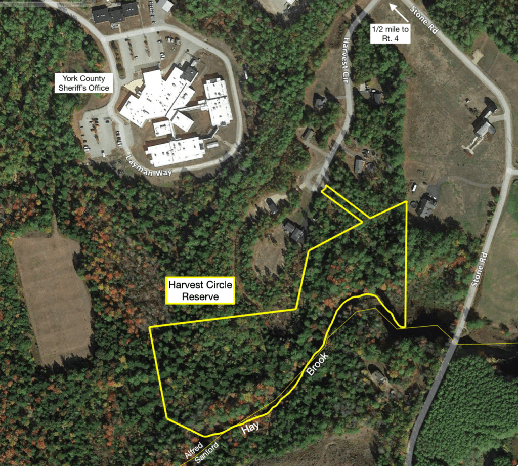
Harvest Circle
Located in Alfred and obtained as part of the Harvest Circle cluster housing development requirement for a common green space, Harvest Circle abuts the Sanford boundary at Hay Brook along its southern boundary. ( Further description under development )
-
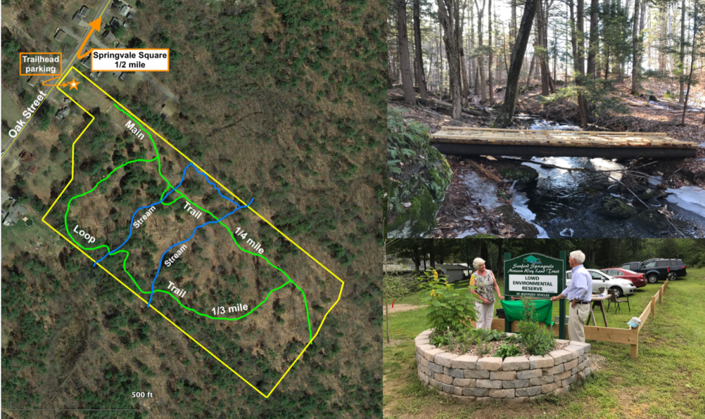
Lowd Environmental Reserve
In 2020, The Lowd Environmental Reserve was added to the Trust’s holdings, the result of a generous donation of 14 acres of land off Oak Street, just ½ mile from Springvale Square. Rebecca and Donald Legro were honored at the Summer dedication well attended by family members and trust directors. A popular walking area for…
-
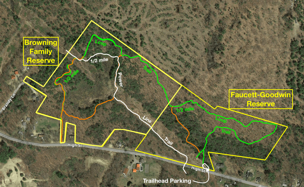
Fawcett-Goodwin Reserve
On April 2, 2014, Carol and Gary Goodwin donated this 18 acre parcel, after 30 years of ownership, to ensure family-time memories of the land could be memorialized, and to allow others to experience the same joys. Searching for mayflowers and various berries with Carol’s father, Raymond Fawcett, were special days, as was cutting firewood,…
-

Central Maine Power at Deering Heights Reserve
Around 2012, Central Maine Company (CMP) built a power line, disturbing delicate wetlands. To mitigate for this impact, CMP was required to provide the area with similar wetland habitat, and to protect it in perpetuity. Land was purchased from Mark Brown, established as a Conservation Area, and given to Mousam Way Land Trust for this…
-
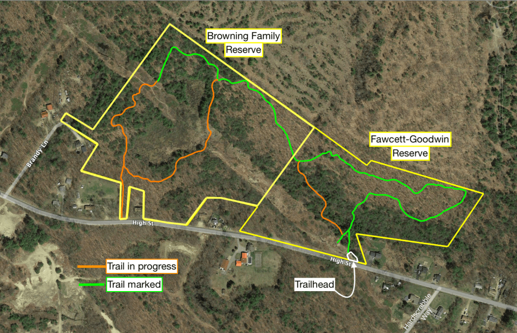
Browning Family Reserve
Donated by Mrs. Gail Browning in October, 2020, The Browning Family Reserve is a 27 acre property along High Street in Sanford. Located at the street’s highest elevation, her family had planned to build their house there, but after building elsewhere, it was her wish to preserve it for others to enjoy, as she did…
-
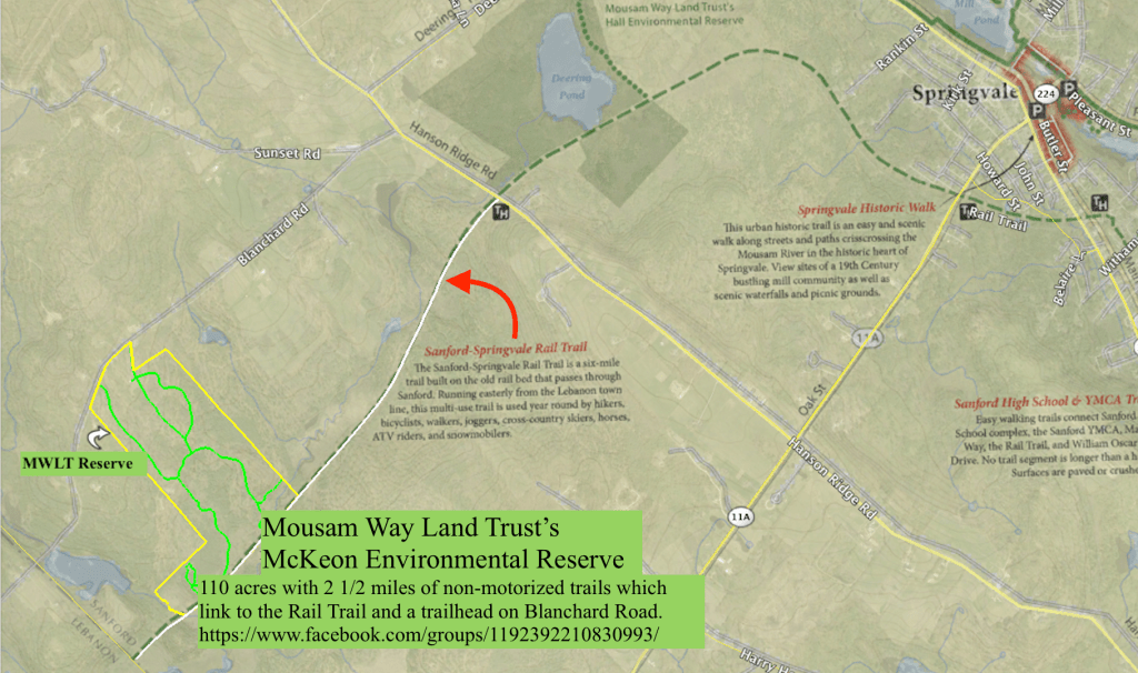
McKeon Environmental Reserve
The educational, experimental, and community outreach center of The Mousam Way Land Trust.
