History:
The Jacobs family occupied the land that today is the IDC Park. They were there early in Sanford’s history. Towards the late 1800’s the Ellis and Quint families lived here. Farming the land must have been difficult because of the droughty, infertile and fire prone nature of the soils and vegetation. The rest of the land is wet most of the year.
Within the past 30 or so years gravel and trees were removed from the park area, activities that the earlier occupants of the land must have engaged in. The abandoned bed of the Atlantic Shore Trolley Line cuts across the park and forms part of the southern boundary of this reserve.
The devastating closure of the Goodall Mills spurred the formation of the Sanford Industrial Development Corporation in 1959 by local citizens and many members of the Chamber of Commerce. The Corporation purchased the tract of land between Route 109 and the Mousam River and built a building on speculation. This was later leased by Sprague Electric Company in 1965. In 2010, the building was demolished, and in 2019 a Marc Motors auto dealership was constructed.
The shape of this reserve is defined by the sharp northward and then eastward turn of the Mousam River. When glacial melt water flowed through here many thousands of years ago it probably continued on a straight course and connected with what is now called Branch Brook. As the water flow lessened it was diverted to its present course around an emerging bar of sand and gravel.
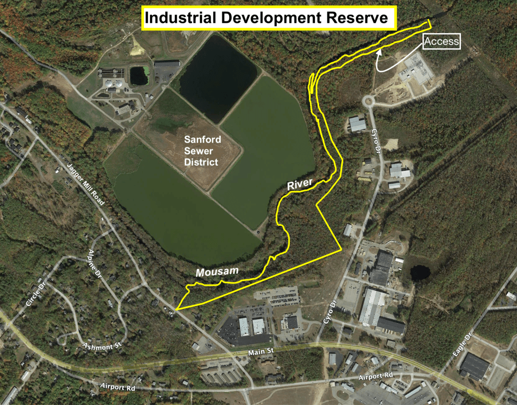
Significance:
The entire northerly boundary of the reserve runs along the thread of the Mousam River for one and a quarter miles. There are several plant communities over this stretch and, therefore, several habitats for wildlife. The river at this point is rated as a medium value fish habitat. Bait containers, bobbers and snarled nylon filament support this observation. The adjacent riparian zone is rated as high value wildlife habitat.
The point at which the Sanford Water Districts water line crosses the river provides a launch and recovery area for small hand powered water craft. The water line easement allows access from the circle at Cyro Drive.
Management Plan:
Most all of this land lies within the 100 year flood plain and the Shoreland Zone. The best management practice because of inaccessibility would be to let natural succession take place.
